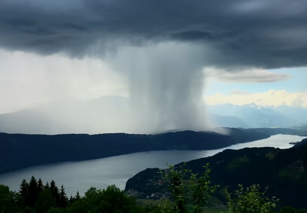
Often we hear the news of clouds bursting in hilly regions but have you ever wondered why clouds actually burst? Is it some kind of natural phenomenon or something else, and if a cloud bursts somewhere then how dangerous it can be?
Uttarakhand, a hilly state of India, is famous all over the world for its natural beauty, especially in the summer season, when tourists across the world love to visit here. Because while in other states one feels the scorching heat during the summer season, the beautiful view of Uttarakhand forces you to forget the hotness. Moreover, in winter, one would get to see a different paradise here. But behind the beauty of this place, a dangerous aspect is also hidden and that is cloudburst. In the last few years, there has been a rapid increase in the incidents of cloudbursts in India, due to which many people had to lose their lives.
So when it comes to cloudburst, it is like bursting a water balloon. For example, suppose there is a balloon filled with water, in which there is a hole, and then all the water pours down through that hole. This is exactly what happens when a cloud bursts. In simple words, when a cloud bursts, all the water present in the cloud suddenly starts falling down very rapidly in the form of heavy rainfall. And when so much water comes together in one place, it is obvious that this water will take the terrible form of a flash flood and when there is a flood, then everyone knows how terrible the damage would be. Earlier, a cloudburst occurred in Dharamshala leading to massive flash floods.
Although there is no prediction of cloudburst, but clouds have their own special patterns which are formed only at certain places, which are very important to understand. Now if we talk about the first pattern, then it is a bowl-shaped place, it is such a place that is surrounded by high mountains from all sides and there is an empty plain in the middle. At such places, clouds keep accumulating layer by layer, due to which when new and hot clouds meet cold clouds, a huge amount of electricity is generated in them. Then the lightning that occurs holds the water in the clouds and does not allow it to rain down.
Read:-What Are Waterspouts? What Is The Cause Behind Their Formation?
As the new clouds mix with the old clouds, these clouds become quite heavy, whose weight can be in millions of tons. Finally, when the clouds cannot handle the weight of so much water, all the water pours down abruptly in a few minutes in one place in a terrible way. Now, when so much water falls at one place at a high speed, then all the mountains, rocks, trees, etc. present in the area go away along with the water, and such devastation is seen in front of which whatever comes in the way it just floats away.
Cloudbursts are more common in states like Uttarakhand, Himachal Pradesh, and Kashmir during the onset of monsoon. But among them, Uttarakhand is more affected because, for the last few years, many incidents of cloudburst have been surfacing every monsoon. In such a situation, there is a big question that why so many clouds are bursting in Uttarakhand. So let's understand its reasons.
Read:-"The Mysterious Death Of Starfish", "Seafood Rain", And "The Annual Capelin Roll"
The Tehri Dam in Uttarakhand is the highest dam in India and the fifth highest in the world. The height of this dam is 260.5 m and it is capable of generating more than 2000 MW of electricity per year. This dam is built at the confluence of two important Himalayan rivers Bhagirathi and Bhilangana. By damming the water of both these rivers, a huge amount of water is stored behind so that it can be used to generate electricity. And maybe this is the main reason for the cloudburst.
Due to this giant lake, a huge amount of water evaporates, which leads to the formation of clouds in an unnatural way. If it is believed that when the dam was being built, the Bhagirathi and Bhilangana were only 20 meters wide, thus the water available for evaporation was only 1.3 square kilometers. Now, to make the reservoir of the dam, the width of the rivers is considered to be 500 meters, then the surface area of water available for evaporation will be 32.5 square kilometers. Now it can be inferred that the evaporation from such a large reservoir means the formation of enormous and unusually large clouds. Now it is obvious that when such a large number of clouds are formed, the incidents of cloud bursts will increase.
Read:-What Is Milky Sea Effect? A Mysterious Glow In The Ocean
Now if we talk about the second pattern, it is often seen in the areas around the sea, where the evaporation of water is in very large amounts. But this method of cloudburst is very different in such a place like take the floods of Mumbai in 2005. There was a cloudburst too, but its way was completely different from the cloudburst in Uttarakhand. Here the clouds did not collide with any solid object or mountains but with hot winds and then these clouds rained so heavily that 994 mm of water rained within just 24 hours. This rain was so strong and torrential that by the time people could understand anything, it was too late. With this downpour, people were so troubled that huge devastation was seen in Mumbai.


0 comments:
Post a Comment