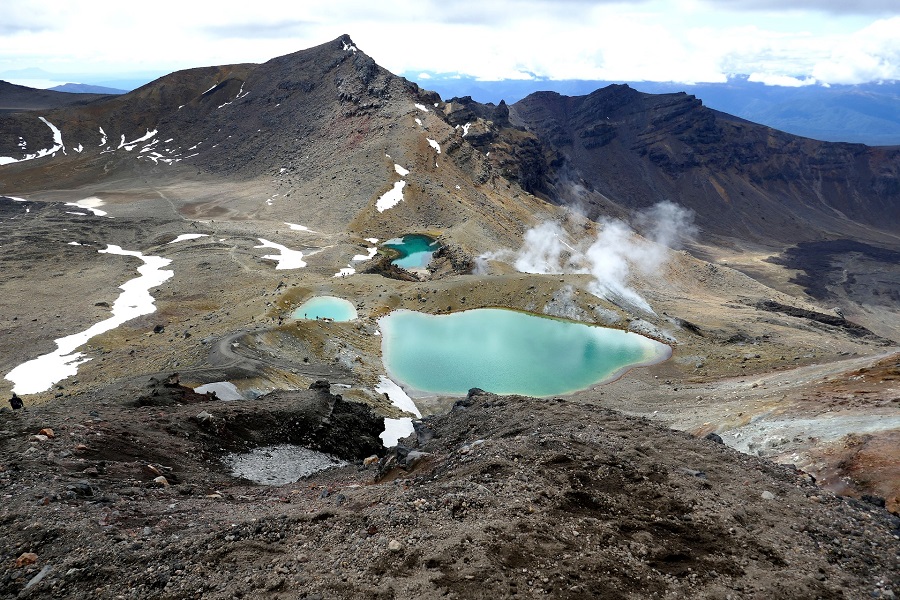
Tongariro Alpine Crossing is one of the most amazing sites in New Zealand that provides some of the most incredible and gorgeous views in the country. It is a kind of a tramping track located in the Tongariro National Park, a World Heritage site. The tramping track is usually known for long distance walking or hiking for at least one overnight stay. By having a full distance of 19.4-kilometer, this track has a challenging journey across a remarkable volcanic landscape and considered as the most popular day hikes in the country. This amazing walk passes through the volcanic terrain of the multi-cratered active volcano Mount Tongariro that has some old lava fields, steam vents, emerald-colored lakes, and some fantastic scenes along its way. The volcanic activity of the park is constantly being monitored, as well as the warning signs are placed at different points along the trail that warns hikers about what to do if there occurs an eruption.
Image Credit - Pixabay
The Tongariro Alpine Crossing is usually walked from Mangtepopo in the Ruapehu region to Ketetahi Hot Springs because the Mangatepopo end is at a height higher than the Ketetahi Hot Springs end, hence less climbing is required, so starting here eliminates almost 200 meters of climbing. The lowest point of the Tongariro Crossing is Ketetahi Car Park, which is at 760 m. The summit of the Red Crater is the highest point on the Tongariro Alpine crossing. From here the track descends down to Emerald Lakes. The magnificent color of emerald lakes is caused by the minerals from the adjoining thermal area. All the lakes and pools on the walk are deeply colored by the volcanic minerals dissolved in them.
The walk mostly goes through the raw volcanic terrain. There are three volcanoes in the area that all are highly active and the terrain revealed this whole scene by itself. There you will find plenty of lava flows, steam vents, and loose tephra. Large amounts of minerals are brought to the surface and are highly visible in the colors of rocks and ridges. Due to the minerals dissolved from volcanic rocks, it is not suitable for drinking water in the Mangteppo stream. You will get different colors on the lava flows as you walk up the valley. The color of the surface of the younger lava is darker and absorbs much of the sun's heat, which creates a harsh environment for the growth of plants and this is the reason why the youngest flows only have a few plants. But in the older flows, there are progressively more species and larger plants. Several fumaroles are active on different sections of the walk that are continuously releasing steam and sulphur dioxide gas into the air and depositing yellow sulphur specks around their edges.
Image Credit - Wikipedia
Image Credit - Pixabay
The Tongariro Alpine Crossing is usually walked from Mangtepopo in the Ruapehu region to Ketetahi Hot Springs because the Mangatepopo end is at a height higher than the Ketetahi Hot Springs end, hence less climbing is required, so starting here eliminates almost 200 meters of climbing. The lowest point of the Tongariro Crossing is Ketetahi Car Park, which is at 760 m. The summit of the Red Crater is the highest point on the Tongariro Alpine crossing. From here the track descends down to Emerald Lakes. The magnificent color of emerald lakes is caused by the minerals from the adjoining thermal area. All the lakes and pools on the walk are deeply colored by the volcanic minerals dissolved in them.
Image Credit - Wikipedia
 |
| View of a harsh volcanic landscape |


0 comments:
Post a Comment